Table of Contents
Introduction
As winter approaches, the big question is, “will it be a cold winter?” or maybe for some, “how much snow will we get?” Here in west central Georgia, my students commonly ask if we’ll see any snow in the coming winter. In the fall, the rumors often circulate on social media: “the earlier snow cover appears in Siberia, the more likely a cold, snowy winter becomes in North America”. As great as it would be if nature followed such simple causality, the reality is more complex.
So what is the truth behind this connection between autumnal snow cover in Eurasia and winter temperatures in North America? We’ll assess the nuances of this relationship, and then we’ll take a deep dive into two papers that have examined the linkage. We’ll end with some takeaways about what to look for as an indication that this connection is taking hold.
The Snow Cover–Cold Winter Connection
The connection between early snow cover and cold winters is straightforward: as snow cover expands across Eurasia in early autumn, it increases surface albedo, reflecting more sunlight back to space. With less solar absorption at the surface, radiative cooling accelerates near the ground. This cooling strengthens the shallow high-pressure system that often forms over Siberia and increases the temperature gradient between land and the still-warm Arctic Ocean. Increased baroclinicity from this temperature contrast alters planetary waves that determine the large-scale circulation. This shift can transfer wave energy upward toward the stratosphere. Under the right conditions, that energy can disturb the polar vortex weeks later.

Why It’s More Complicated
A Modest Correlation
Several studies have documented statistical links between October Eurasian snow extent and winter circulation patterns across the Northern Hemisphere. These relationships are measurable but modest: correlations with indices such as the Arctic Oscillation or regional sea-level pressure patterns often reach 0.3 to 0.5, while correlations with U.S. surface temperature are generally weak and not statistically significant.
The strength and sign of the connection vary by region and by year and also depend heavily on other factors, including Arctic sea-ice anomalies, the phase of the El Niño-Southern Oscillation (ENSO), and the configuration of large-scale patterns such as the Arctic and North Atlantic Oscillations. Early snow cover can contribute to a colder winter, but only when these additional influences align to support planetary-wave amplification and effective stratosphere-troposphere coupling.
Land Surface Preconditioning
A hidden influence involves the land surface conditions over northern Eurasia as snow begins to accumulate. Snow alone does not guarantee strong wave generation; the underlying soil moisture, residual summer warmth, and early-season freeze–thaw cycles all affect how deeply the surface cooling penetrates.
If the land surface retains heat through warm subsurface soils, patchy snow, or anomalous autumn warmth, then snow expansion produces weaker pressure anomalies than expected. Conversely, when the soil is already dry and cool, even modest snow growth can produce a stronger Siberian high. This land surface “readiness” modulates whether planetary waves meaningfully amplify or remain shallow and ineffective.
Large-Scale Oscillations
The Arctic Oscillation and North American Winters
The Arctic Oscillation (AO) describes the strength and configuration of the atmospheric pressure pattern between the Azores High and the Icelandic Low. A positive AO corresponds to lower-than-normal pressure over the Arctic and stronger midlatitude westerlies. This phase keeps cold air bottled up near the pole, producing milder-than-average winter conditions across much of the United States.

Source: https://www.climate.gov/news-features/understanding-climate/climate-variability-arctic-oscillation
A negative AO, by contrast, features higher pressure over the Arctic and weaker westerlies, often allowing cold Arctic air to descend into North America and Eurasia. Snowfall prospects also tend to increase: a negative AO increases the likelihood of significant East Coast snowstorms because cold air is more readily available when coastal storms develop. Importantly, the AO is highly variable and can shift rapidly, meaning its influence often occurs in shorter intra-seasonal bursts rather than across the entire winter.
The North Atlantic Oscillation and North American winters
The North Atlantic Oscillation (NAO) operates on a similar pressure seesaw between the midlatitudes and the Arctic but exerts its strongest influence on winter weather in the eastern United States and western Europe. A negative NAO weakens the Icelandic Low and shifts the jet stream southward, fostering blocking patterns over Greenland. This configuration can usher cold air into the eastern United States and enhance the chances of major nor’easters with heavy snowfall.

Source: https://www.climate.gov/news-features/understanding-climate/climate-variability-north-atlantic-oscillation
In contrast, a positive NAO strengthens the Atlantic jet, sending storms northward and generally producing warmer, less snowy conditions across the eastern U.S. The NAO frequently varies on weekly to monthly timescales, meaning its phase during individual storm windows often matters more than its seasonal average.
Tropical Convection and the Madden–Julian Oscillation
While Eurasian snow cover and Arctic processes often dominate midlatitude winter discussions, the tropics exert an equally powerful and more immediate influence on the polar jet and on downstream weather. The Madden–Julian Oscillation (MJO) is a large-scale pulse of tropical convection (thunderstorm activity) that travels eastward around the equator every 30-60 days. As it moves, it alters heat release, atmospheric wave patterns, and the positioning of jet streams far beyond the tropics.
During winter, when MJO convection is active over the western Pacific (phases 6–7), it strengthens and extends the Pacific jet stream. This promotes wave propagation into the Arctic, which can weaken the polar vortex and lead to colder conditions across North America two to four weeks later. Conversely, when the MJO lingers over the Indian Ocean (phases 2–3), the resulting wave train often reinforces a stronger, more circular vortex, favoring milder conditions in the east.

Source: https://www.climate.gov/news-features/blogs/enso/what-mjo-and-why-do-we-care
The MJO also interacts with ENSO, as El Niño and La Niña events modify where tropical convection tends to occur. A La Niña background, like the one expected this winter, typically favors MJO activity in the western Pacific, which can still generate upward wave energy that disturbs the polar vortex despite a tendency toward confinement. This interplay between tropical convection, planetary waves, and stratospheric dynamics is a key pathway through which the tropics influence high-latitude weather.
ENSO and North American winters
General conditions
ENSO is one of the most influential drivers of winter weather in North America because it reorganizes tropical convection across the Pacific. During El Niño, enhanced thunderstorm activity over the central and eastern equatorial Pacific strengthens the subtropical jet stream and shifts it south and east. This pattern brings wetter, stormier conditions to the southern tier of the United States and can increase snowfall from California to the Carolinas. It often leads to milder conditions across the northern tier of the U.S. because the enhanced jet discourages Arctic air from plunging south.

Source: https://science.nasa.gov/earth/explore/el-nino/
Conversely, during La Niña, convection shifts westward toward the western Pacific, strengthening the North Pacific jet but positioning it farther north. This favors colder, snowier winters across western and central Canada and the northern United States, while much of the southern tier tends to be warmer and drier. For 2025–2026, a weak La Niña suggests perhaps a weak tendency for this northward-shifted storm track, which might partially counteract cooling signals from early-season Eurasian snow.
A La Niña that persists through an entire winter tends to organize the tropical Pacific in a stable and predictable way, since convection remains concentrated over the western Pacific and the Pacific jet maintains a consistent structure. This stability generally strengthens the polar vortex and suppresses upward planetary-wave propagation, which limits the ability of Eurasian snow cover, Barents–Kara ice anomalies, or Ural blocking (discussed below) to influence the stratosphere.
Phase transitions
When La Niña decays early and the subsurface Pacific begins transitioning toward El Niño, the tropical forcing loses that coherence. Convection becomes intermittent, westerly wind bursts appear more frequently, and the Madden-Julian Oscillation (discussed below) tends to amplify rather than remain muted. These changes weaken the stabilizing influence that a sustained La Niña normally exerts on the vortex.
During a phase transition, the Pacific jet does not hold a single configuration but instead alternates between La Niña-like and El Niño-like states as the atmosphere attempts to reorganize. This behavior creates windows in which midlatitude and high-latitude forcing can transmit wave energy upward more effectively, since the jet no longer blocks those intrusions in a uniform way.
Even brief periods of MJO activity in phases that support poleward wave propagation can produce stronger disturbances, which means that snow-driven or Arctic-driven wave signals have a greater chance of reaching the stratosphere. The background state becomes permissive rather than resistant, and the polar vortex becomes more sensitive to external forcing.
Summary: Oscillations and North America winter
Because ENSO, MJO, AO, and NAO frequently interact, their combined influence can amplify (or suppress) any snow-related signals from Eurasia. For example, early Siberian snow cover may promote a weaker polar vortex later in winter, but a strong positive AO or NAO at the same time can easily prevent Arctic air from reaching North America.
Likewise, a La Niña pattern that supports a robust North Pacific jet can stabilize the polar vortex, reducing the likelihood that early-season snow cover triggers a significant cold outbreak. However, transitional states of these oscillations may behave differently than sustained states: for example, polar vortex stabilization becomes less likely when La Niña is transitioning to El Niño.
In practice, these oscillations set the broader background state for the winter season; snow cover acts only as one contributor within a larger, multi-factor system that ultimately determines North America’s winter temperature and snowfall patterns.
Downstream Amplification
The link between snow cover and the polar vortex strengthens only when early snow expansion initiates a cascade of downstream atmospheric responses. As Eurasian snow grows rapidly in October and November, radiative cooling over the continent intensifies and strengthens the Siberian high. This altered surface pattern changes the distribution of temperature and pressure in a way that favors the growth of stationary planetary (Rossby) waves.
These waves propagate upward and poleward, and under the right background conditions, such as a conducive jet-stream configuration or favorable tropical forcing, they can reach the lower stratosphere. Once there, they begin to decelerate the polar-night jet and warm the stratosphere through adiabatic compression, setting the stage for a possible weakening or distortion of the polar vortex.
If the upward-propagating waves are strong enough, they can meaningfully disrupt the polar vortex by stretching it, displacing it, or in extreme cases initiating a sudden stratospheric warming (SSW). These disturbances do not immediately translate into surface weather: they typically descend through the stratosphere over the course of 10-20 days, eventually altering the jet stream and enabling Arctic air to move south into North America and Eurasia.
However, if the wave signal is weak (or if other factors, such as a strong La Niña or a positive AO, suppress upward wave propagation) the initial Eurasian cooling remains confined near the surface and fades with little large-scale impact. In those years, early snow cover serves as a necessary but insufficient ingredient, unable to influence midlatitude winter unless the full stratospheric–tropospheric coupling pathway is activated.
A Deeper Dive into the Literature
A Closer Look at the Cohen et al. Study
In their 2021 Science article, Judah Cohen et al. examined how Arctic change and Eurasian snow cover connect to extreme winter weather in the United States. Using a blend of reanalysis data, modeling, and statistical analysis, they investigated two potential precursors of polar vortex disruption:
- Autumn Eurasian snow cover, and
- Early-season Arctic sea-ice loss, particularly in the Barents–Kara Seas.
The study’s goal was to clarify how surface changes propagate upward to influence the stratospheric polar vortex (SPV) and eventually descend to affect surface weather patterns.
Key findings:
- The authors identified a recurring mode of vortex disturbance they termed “stretching”: a deformation rather than full collapse of the SPV. In this mode, the vortex elongates, shifting its core toward Eurasia or North America. This configuration is linked to colder surface temperatures over parts of both regions.
- Wave–mean-flow interactions are central: decreased Arctic sea-ice and expanded Eurasian snow cover enhance upward propagation of planetary waves (wavenumbers 1–2), which disturb and displace the SPV.
- The tropospheric response typically manifests as a ridge over the North Pacific and a trough over eastern North America, a pattern conducive to Arctic outbreaks.
- Despite this, the direct correlation between October snow cover and U.S. surface temperature remains weak and statistically insignificant in most regions. The strongest U.S. signal occurs in sea-level pressure, with lower values near Montana.
- The authors emphasize that this connection is conditional, not deterministic: it depends on supportive wave activity, sea-ice anomalies, and tropical forcing (MJO/ENSO). Internal variability can enhance or suppress the pathway in any given year.
- Their findings reinforce that early snow cover and sea-ice loss serve as “priming” mechanisms for a more disturbed SPV…but do not guarantee cold winters.
Implications:
The Cohen et al. study reframes the snow–cold relationship as part of a multi-step cascade:
- Autumn snow expansion and Arctic sea-ice anomalies alter temperature gradients.
- These changes amplify upward-propagating planetary waves.
- The waves disturb the SPV, producing either a stretching or weakening event.
- That stratospheric anomaly descends weeks later, influencing jet-stream position and surface weather.
This cascade explains why early snow cover alone cannot reliably predict winter outcomes: without the wave amplification or stratospheric coupling, the link remains latent.
Complementary Evidence from Gastineau et al. (2017)
A related study by Gastineau et al. (2017) examined the influence of autumnal Eurasian snow cover on Northern Hemisphere circulation in both reanalysis (1979–2014) and CMIP5 control simulations. They focused on how November snow-cover extent (SCE) anomalies, especially over eastern Siberia, relate to subsequent changes in the Arctic Oscillation (AO) and polar vortex.
In observations, they found that a dipole pattern of November snow anomalies (reduced snow over eastern Europe and increased snow over eastern Siberia) is typically followed one to two months later by a negative AO phase, characterized by higher pressure over the Arctic and lower pressure over the midlatitudes. This signal was strongest over the eastern Siberian “pole” of snow anomalies, which is itself shaped by the Scandinavian pattern (SCA): a persistent anticyclonic anomaly over the Urals that favors Siberian snow growth and links it to reduced sea ice in the Barents–Kara Seas.
Their analysis suggests that increasing snow cover extent over Siberia leads to lower-tropospheric cooling there and relative warming over the eastern Arctic, followed by a weakened polar vortex and AO-like response in December–January. The connection strengthens when Barents–Kara sea-ice is low, implying that snow and sea-ice anomalies can work together to precondition the vortex for disturbance. However, most climate models under-represent this coupling, underscoring how sensitive the process is to model physics and internal variability.
Together with Cohen et al. (2021), the Gastineau et al. (2017) results show that regional details of Eurasian snow, especially over eastern Siberia and under circulation regimes like the SCA, matter as much as overall hemispheric snow extent. The evidence supports the idea that snow cover can help steer the winter AO and polar vortex, but only if it does so in concert with sea-ice anomalies and the background flow pattern.
How to Tell When the Pattern Is Taking Hold
The snow–vortex connection usually unfolds over several weeks, and its early stages leave distinct fingerprints in the data. By late autumn, forecasters and researchers look for a combination of surface, stratospheric, and tropical indicators suggesting that the atmosphere is coupling toward a colder midlatitude regime.

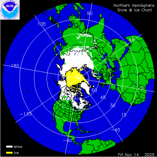
Source: https://usicecenter.gov/products/ims/ims_v3/ims_gif/
ARCHIVE/NHem/2025/ims2025318.gif
1. Rapid Eurasian Snow Expansion – When snow cover over central and eastern Siberia grows quickly during October–November, it cools the lower atmosphere and strengthens the surface high over Eurasia. The faster and broader the growth, the greater the potential for planetary waves to amplify upward into the stratosphere.
2. Ural Blocking and Barents–Kara Sea Ice Loss – A ridge of high pressure over the Urals (a “Ural block”) combined with reduced sea ice in the Barents–Kara Seas enhances vertical wave activity flux, often the first sign that the vortex may weaken.
3. Stratospheric Wave Activity Flux in the vertical direction (WAFz) – A surge in upward-directed wave-activity flux and warming near 10 hPa indicates that energy from the troposphere is disturbing the polar vortex. If zonal (west-to-east) winds at 60° N slow dramatically, a vortex disturbance – or even a sudden stratospheric warming – may be underway.
What is wave activity flux? (click to expand)
Wave-activity flux (often abbreviated WAF or WAFz for its vertical component) is a diagnostic used by atmospheric scientists to track how planetary waves move energy and momentum through the atmosphere. These waves, generated by contrasts in temperature, topography, and surface pressure patterns, can travel upward from the troposphere into the stratosphere.
WAF shows the direction and strength of that propagation.
Strong upward WAFz indicates that large-scale waves are pushing into the stratosphere, where they can slow the polar-night jet and weaken the polar vortex.
Weak or downward WAFz means little wave energy is disturbing the stratosphere, allowing the vortex to remain strong and well-contained.
For the snow–vortex relationship, WAF is the critical link: early-season Eurasian snow can help generate stronger planetary waves, but the polar vortex only responds when those waves produce substantial upward wave-activity flux. This is why some years with extensive October snow show no downstream effects: without strong WAF, the stratosphere remains untouched.
4. MJO Phases and Tropical Forcing – If the Madden–Julian Oscillation moves into phases 6–7 during December or January, its convection can reinforce the same upward wave flux that perturbs the vortex. A weak La Niña background slightly favors this pattern.
5. Downstream Jet and Temperature Anomalies – Once the stratospheric signal descends, a ridge usually strengthens over Alaska, a trough deepens over eastern North America, and temperatures fall across the central and eastern United States…typically 10-20 days after the initial disturbance.
Tracking these indicators together (snow growth, Ural blocking, wave flux, MJO phase, and jet reconfiguration) offers the clearest picture of whether the pattern described in Cohen et al. (2021) and Gastineau et al. (2017) is beginning to take hold.

Download a larger version of the above graphic:
Necessary but Not Sufficient
In short, early snow cover is often necessary but not sufficient for a cold North-American winter. Most cold winters follow early snow expansion, but many early-snow years are followed by mild seasons. The pattern works best as a contextual signal, not as a forecast in itself.
Conclusion
October snow cover offers a glimpse into how the Arctic and midlatitudes communicate…but it’s only one voice in a larger conversation that includes tropical oceans, planetary waves, and the evolving state of the polar vortex. The relationship is real, but it speaks in probabilities, not guarantees. Recognizing that complexity allows us to appreciate both the beauty and the limits of seasonal prediction.
Further Exploration
A list of references is provided at the bottom of this article. These studies present the picture of a dynamic, interconnected atmosphere in which surface anomalies, tropical convection, and stratospheric variability interact to shape midlatitude winters. The evolving picture shows that no single factor – snow cover, ENSO, or the polar vortex – acts in isolation. Instead, they form a coupled system of feedbacks linking the tropics, stratosphere, and high latitudes. Readers interested in the physical pathways behind these interactions can explore the research cited below, which provides both the historical foundation and current advances in understanding Arctic-midlatitude linkages.
Want to receive future posts in your inbox? Be sure to subscribe to this blog using the “Newsletter” link at upper right. This work is made possible by those who believe in it. Thank you for considering a gift to help ensure its continued momentum.
Author’s Note: This summary is freely available for educational use. Please cite “Jessup, S. (2025). How Snow Cover Really Relates to Cold Winters” in scholarly work.
References
Cohen, J., Agel, L., Barlow, M., Garfinkel, C.I., and White, I. (2021). Linking Arctic variability and change with extreme winter weather in the United States. Science, 373(6559), 1116–1121. https://doi.org/10.1126/science.abi9167
Gastineau, G., García-Serrano, J., and Frankignoul, C. (2017). The Influence of Autumnal Eurasian Snow Cover on Climate and Its Link with Arctic Sea Ice Cover. J. Climate, 30(19), 7599–7619, https://doi.org/10.1175/JCLI-D-16-0623.1.
Butler, A. H., Seidel, D. J., Hardiman, S. C., Butchart, N., Birner, T., & Match, A. (2015). Defining sudden stratospheric warmings. Bulletin of the American Meteorological Society, 96(11), 1913–1928. https://doi.org/10.1175/BAMS-D-16-0293.1
Kang, W., & Tziperman, E. (2018). The MJO-SSW Teleconnection: Interaction Between MJO-Forced Waves and the Midlatitude Jet. Geophysical Research Letters, 45, 4400–4409. https://doi.org/10.1029/2018GL077937
Henderson, G. R., Peings, Y., Furtado, J. C., & Kushner, P. J. (2018). Snow–atmosphere coupling in the Northern Hemisphere. Nature Climate Change, 8, 954–963. https://doi.org/10.1038/s41558-018-0295-6
Vavrus, S. J., Wang, F., Martin, J. E., Francis, J. A., Peings, Y., & Cattiaux, J. (2017). Changes in North American atmospheric circulation and extreme weather: Influence of Arctic amplification and Northern Hemisphere snow cover. Journal of Climate, 30(11), 4317–4333. https://doi.org/10.1175/JCLI-D-16-0762.1