
Table of Contents
Introduction
Early next week, much of the eastern United States will feel the season’s first deep chill as Arctic air sweeps south. Forecast models trace this outbreak to a familiar but often misunderstood feature of the atmosphere: the polar vortex. The term has become a catch-all for any blast of cold, yet the real phenomenon is far broader and more complex. It is not a storm, nor a singular event, but a vast circulation that normally confines frigid air near the poles.
Note: A more general (and somewhat more technical) post about how snow cover can produce cold-winter patterns is also available. If you are looking for deeper insight I recommend both…but this one first.

Source: Pivotal Weather
Normally, the polar vortex constrains cold air in the upper troposphere and stratosphere at Arctic latitudes. When the vortex weakens or splits, its cold reservoir spills outward. These southward surges, known as polar vortex episodes, mark the breakdown of the system that usually holds Arctic air in place. Jet streams buckle and cold pools migrate far from their source. The resulting pattern can linger for days to weeks, sending persistent waves of cold across the continents and reorganizing storm tracks as it goes. Understanding such breakdowns helps explain why certain winters bring sharper, longer cold spells than others, and why the eastern half of North America often bears the brunt.
As a new outbreak approaches, it offers a timely window into how the polar vortex functions, why it sometimes falters, and what its changing behavior may reveal about a warming climate.
What is the polar vortex?
High above the surface, the atmosphere organizes itself into broad, persistent wind patterns. One of the most dominant is the polar vortex, a ring of westerly winds that encircles the Arctic during winter. It forms naturally each year as the polar night cools the upper atmosphere, creating a steep temperature gradient between the dark, frigid pole and the sunlit midlatitudes. Air pressure falls over the pole, and the resulting imbalance begins to spin. This motion is caused by Earth’s rotation, which deflects moving air toward the right in the Northern Hemisphere. This Coriolis effect transforms simple north–south flow into a powerful, encircling current that can extend from the lower stratosphere down into the troposphere: the layer where most weather occurs.

Source: https://www.ucdavis.edu/climate/definitions/what-is-the-polar-/vortex
In its stable phase, the polar vortex acts as a containment system. Strong upper-level winds keep cold, dense air bottled up near the pole and maintain a clear thermal boundary between polar and midlatitude regions. When those winds remain fast and circular, the polar vortex remains confined to the Arctic, and winter temperatures across the United States and Europe tend to stay relatively moderate.

Source: https://www.noaa.gov/jetstream/atmosphere/layers-of-atmosphere
However, the vortex is not a single, solid structure. It is a dynamic circulation made up of interacting layers: one in the stratosphere roughly 10–50 kilometers above the ground, and another in the troposphere below. These layers can move somewhat independently, and disturbances that start in one can influence the other. When the stratospheric vortex weakens, its instability can cascade downward, disrupting the tropospheric jet stream and setting the stage for cold air to escape southward.
Why does it spread south?
The polar vortex does not collapse on its own. Its breakdown begins when large-scale atmospheric waves (known as Rossby waves) disturb the smooth west-to-east flow of air around the pole. These planetary waves form naturally as the jet stream meanders around mountain ranges, land–sea contrasts, and areas of strong temperature difference. When they grow in amplitude, they push air north and south in broad undulations, transferring momentum and energy upward into the stratosphere.

Source: https://www.youtube.com/watch?v=t9GdAXScGh0
If the Rossby waves become strong enough, they disrupt the vortex from below. The upward transfer of energy slows the westerly winds that normally spin around the pole, allowing warmer air from lower latitudes to intrude upward into the stratosphere. This sudden heating, termed a sudden stratospheric warming, is associated with the weakening or even splitting of the vortex into separate lobes. Once that symmetry is lost, the containment of Arctic air breaks down.

Source: weatherbell.com via https://www.axios.com/2023/02/10/sudden-stratospheric-warming-event-polar-vortex
In the days that follow, the disrupted circulation returns ripple effects back downward. The tropospheric jet stream mirrors the distortion aloft, bending into deep troughs that extend toward the midlatitudes. These troughs act as channels for Arctic air to flow southward, while ridges elsewhere bring unusual warmth to regions farther north. The southward spread of cold, therefore, is the visible expression of a weakened, displaced, or fractured vortex responding to planetary-scale waves that have altered the balance of forces in the upper atmosphere.
Why the Eastern U.S. Often Feels It Most
When the polar vortex loses stability, the jet stream distortions follow preferred pathways shaped by the underlying geography and long-standing circulation patterns. Over North America, the most common configuration involves a ridge of high pressure developing along the western United States and Alaska, balanced by a deep trough over the East. This pattern funnels Arctic air southeastward, steering it toward the Great Lakes and the Atlantic seaboard.

Source: Pivotal Weather via https://theconversation.com/how-frigid-polar-vortex-blasts-are-connected-to-global-warming-110653
The reason lies in how planetary waves reflect off the major mountain ranges and ocean basins. The Rocky Mountains and the Tibetan Plateau act as fixed sources of wave energy that deflect the upper-level flow. When this energy propagates upward and interacts with the vortex, it often favors a “west-ridge–east-trough” pattern across North America. The ridge amplifies over the Pacific Northwest, forcing the jet to dive sharply across the central and eastern states.

Once established, the configuration can persist for weeks. Snow cover enhances surface cooling, while the displaced upper-level jet stream reinforces the trough through feedback with the cold air mass at the surface. The result is a recurring sequence of Arctic outbreaks east of the Mississippi River, even as the western United States remains comparatively mild. Thus, the East’s reputation for dramatic cold spells during polar-vortex episodes stems from geography, planetary-wave behavior, and the self-sustaining feedbacks that lock the pattern in place.
Climate Change, Jet Shifts, and the Polar Vortex
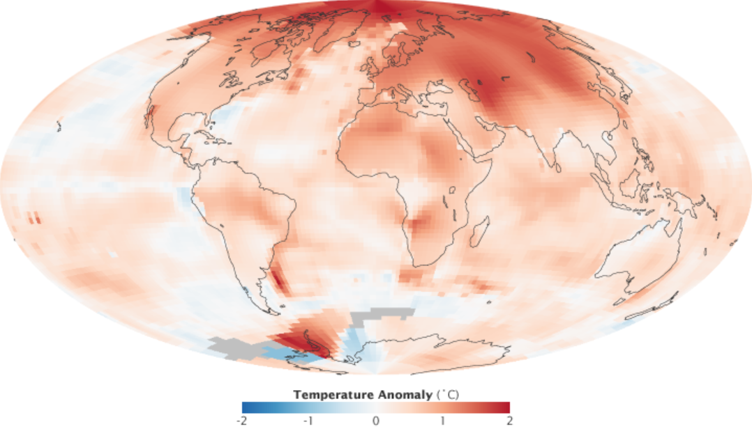
In a warming climate, the polar vortex has become a focus of headlines and click-bait. Arctic temperatures are rising more than twice as fast as those at lower latitudes, reducing the mid-tropospheric temperature contrast that helps maintain a strong, circular jet. Many researchers suspect that this weaker temperature gradient allows the jet stream to meander more easily, promoting the kind of wave amplification that disrupts the vortex. In this view, Arctic amplification (the enhanced surface warming observed in the last several decades in the Arctic) indirectly increases the likelihood of midwinter breakdowns that send cold air surging south.
Source: https://en.wikipedia.org/wiki/Polar_amplification
Other scientists caution that the link is complex. The atmosphere’s variability spans many timescales, and not every cold outbreak can be traced to long-term change. Some climate models suggest that while sudden stratospheric warmings may become slightly more frequent in the future, their timing and impact will still depend heavily on the long-distance teleconnections between natural oscillations such as the El Niño–Southern Oscillation (ENSO) and the North Atlantic Oscillation (NAO).

Source: https://journals.ametsoc.org/view/journals/clim/31/11/jcli-d-17-0716.1.xml
The evidence so far supports a nuanced picture: warming reduces average cold severity overall, yet disturbances in the high-latitude circulation can still create sharp, temporary reversals, such as the recent cold air outbreaks in Texas in February 2023 and January 2024, as well as the Gulf Coast blizzard of January 2025.

Source: Wikipedia
What remains clear is that the polar vortex serves as a sensitive barometer of balance in the atmosphere. When it is strong, the Arctic stays contained; when it weakens, that balance tilts as the jet’s circular momentum gives way to wave-driven exchange, converting what was once rotational stability into equatorward flow. Each episode reveals how deeply connected the planet’s upper-air patterns are, and how even subtle shifts in the jet stream can produce cold air outbreaks far from the pole.
Current Conditions and the Outlook Ahead (November 2025)
Snow Cover Influence
Early-season snow cover across Siberia and northern Canada is already affecting the surface energy balance. When high-latitude land cools rapidly in autumn, it strengthens the temperature gradient between the continents and the still-open Arctic Ocean. That gradient fuels planetary-wave activity, helping Rossby waves grow and propagate upward toward the stratosphere later in the season. If this wave energy persists, it may weaken or displace the polar vortex by mid-winter. The pattern is not automatic, but years with extensive October snowpack in Eurasia and northern Canada have often preceded more variable vortex behavior, as the enhanced surface cooling anchors stronger troughs and encourages upward wave flux.

Source: https://www.nohrsc.noaa.gov/nh_snowcover/
Magnetic Field Influence
Meanwhile, conditions higher in the atmospheric column carry their own signals. As of early November 2025, the Sun remains near the peak of its activity cycle, with increased ultraviolet (UV) output and that energizes the upper atmosphere, while Earth’s magnetic field continues a gradual weakening that modulates how solar particles interact with the polar regions. The enhanced UV radiation splits molecular oxygen in the upper stratosphere, freeing atoms that recombine to form ozone. The resulting ozone then absorbs additional UV energy and releases it as heat, warming the surrounding air.
At the same time, bursts of charged particles from the solar wind follow Earth’s magnetic field lines into the polar atmosphere in a process known as particle precipitation. These particles collide with atmospheric molecules, such as nitrogen, producing nitric oxide and other reactive species that alter how the stratosphere cools by infrared emission.

When the magnetic field is strong, it confines most incoming particles to narrow auroral zones, limiting chemical changes and maintaining a relatively stable stratospheric temperature structure. When it’s weak, more particles penetrate to lower latitudes and altitudes, increasing chemical production of nitric oxides that promote radiative cooling in the upper stratosphere. This cooling can sharpen temperature gradients and temporarily strengthen the polar vortex, but it also preconditions the system for stronger wave disturbances that may later trigger sudden warming events.
El Niño Influence
Currently, a lingering La Niña is in place, and is expected to remain so through much of the winter. During La Niña winters, enhanced convection shifts westward toward the central and western tropical Pacific, while the eastern Pacific remains cooler and more stable. This configuration strengthens the subtropical jet over the western Pacific but often limits the eastward propagation of planetary waves that disturb the polar vortex. As a result, the vortex more often remains stronger and more compact, with fewer midwinter warmings or large displacements of Arctic air.
Even so, the outcome is not fixed. This is not a regular La Niña; a transition to El Niño conditions is becoming increasingly likely next year. During such a phase transitions, conditions can be more variable, which may provide greater opportunities for colder air to advance southward than normal. Individual wave events, snow-cover feedbacks, and solar influences can also introduce instability. Combined with the early Siberian snowpack and active solar conditions, the background state points to a winter marked less by steady confinement and more by intermittent surges of variability, where smaller disturbances may still produce notable cold episodes across North America.
Synthesis
In combination, these effects have the potential to shift the polar temperature structure by several degrees, influencing the strength and stability of the surrounding winds. Therefore, they can influence how readily the vortex responds to incoming wave energy, either reinforcing its containment or preconditioning it for a later breakdown.
Given the early season snowpack and the current solar and magnetic configuration, the coming winter of 2025–2026 appears likely to feature perhaps multiple notable disruptions of the polar vortex, punctuated by alternating periods of deep cold and unusual warmth across the midlatitudes…very similar to the last few years. Computer models are predicting a sudden stratospheric warming event, which would enhance these trends and will likely lead to several cold snaps through early winter. It carries the potential to be a winter with significant cold air outbreaks and also, possibly, at least one major bout of severe weather. Expect a dynamically active, rather than stable, season ahead.
What Meteorological Cosmology Says About Polar Vortex Episodes
From the viewpoint of Meteorological Cosmology, a polar vortex episode is a necessary act of rebalancing. The polar regions store vast quantities of thermal energy in the form of cold: an inverted reservoir of potential. Warm air contains more energy, but a large, contained region of cold air has the potential to carry that coldness elsewhere. When that storage grows excessive, the system reorganizes. What appears as an outbreak of Arctic air is, in this sense, the atmosphere’s way of restoring motion to the cold air that has become stagnant.
Even during the long polar night, when the stratosphere seems calm and undisturbed, quiet tensions build between radiative cooling aloft and the mechanical confinement of the jet. The stability is never absolute; its dynamic stillness is maintained by competing forces. Over time, those forces drift out of balance as wave energy from the lower atmosphere pushes the system away from its center. Eventually, the containment weakens, and the stored gradients are redistributed.
Each episode refines the global circulation. The strong contrasts that drive winter weather are renewed through these exchanges, ensuring that energy does not remain locked in one region indefinitely. In this way, the polar vortex’s breakdowns serve a larger continuity. They are reminders that the atmosphere, like all complex systems, preserves balance not by resisting change but by moving through it.
Note: if you enjoyed this post, you may also be interested learning more in the next post.
Want to receive future posts in your inbox? Be sure to subscribe to this blog using the “Newsletter” link at upper right. This work is made possible by those who believe in it. Thank you for considering a gift to help ensure its continued momentum.
Author’s Note: This summary is freely available for educational use. Please cite “Jessup, S. (2025). The Polar Vortex Explained: Why Winter 2025–2026 Could Bring Repeated Arctic Outbreaks (Weather Explained #3)” in scholarly work.